Get out the map
3D street maps could help help delivery drivers find their way around crowded cities.
Last-mile deliveries have long been one of the most challenging legs of the shipping process, particularly in urban areas, where drivers must contend with limited street parking, traffic congestion, and high-occupancy buildings.
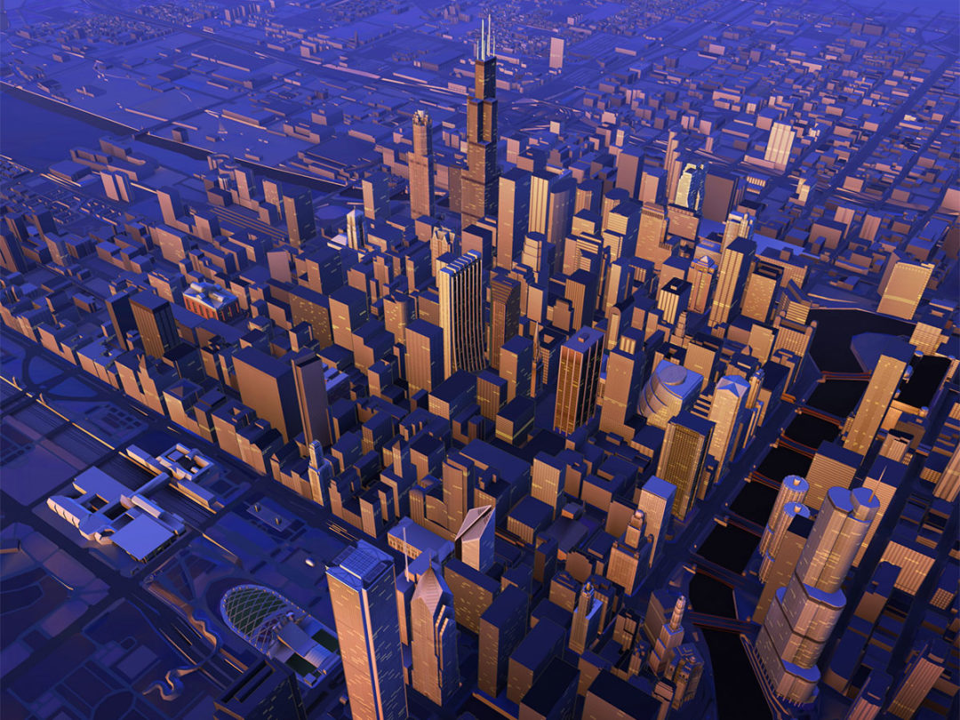
Now, one logistics technology provider says it has developed a tool to address that challenge. The Dutch location-data and technology specialist Here Technologies has created high-fidelity, three-dimensional (3D) models of more than 75 cities around the world to help delivery drivers, urban planners, and others find their way around.
The developer describes the platform as a “real SimCity”—in homage to the popular video game—but says it has very real benefits. Last-mile delivery drivers can use the maps to navigate dense and complex urban environments, pinpointing the exact buildings and entry points they need to find to complete their deliveries.
The technology has applications in other areas as well, the developer says. For example, urban planners can use the maps to test out mass-transit designs, telecommunications networks can use them to decide where to build 5G wireless antennas, and public safety planners could use them to simulate emergency scenarios.
“Here Technologies has captured the world’s major road networks and urban environment for enterprise use cases in 3D,” Jørgen Behrens, the company’s senior vice president and chief product officer, said in a release. “Whereas today we navigate the world within three to five meters (10 to 16 feet) of relative location accuracy, the internet of things is quickly requiring a new level of sub-meter location precision. We’re excited to provide developers across industries with this unique data that opens up a world of applications and possibilities.”